Current Instruments
*Measurement Programs/Instrumentation Maintained on Site by the CERES Radiation Validation Experiment (CRAVE) Team
VADEQ Instrumentation
PANDORA
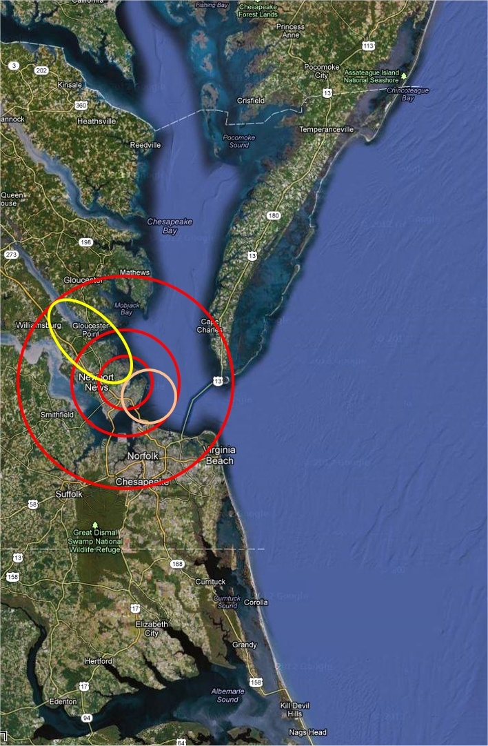
BSRN Site LRC-49
*
PurpleAir PA-II-SD Air Quality Sensor
NASA Aerosol Robotic Network (AERONET)*
Historical Instruments
A listing of instruments previously present at the CAPABLE Site.
NASA Micro-Pulse Lidar Network*[DISCONTINUED in 2022]
2009-2010 Penn State CAPABLE Instrument Suite
ASSIST instrument (Summers 2009 & 2010)
|
Instrument |
Response |
Parameter |
Precision |
Uncertainty |
Range |
Resolution |
|
ASSIST |
~75s |
Temperature, Water mixing ratio, Cloud Fraction |
|
|
0-50km |
variable with altitude |
Lidar instrumentation (Summers 2009 & 2010)
|
Instrument |
Response |
Parameter |
Precision |
Uncertainty |
Range |
Resolution |
|
Leosphere scanning wind lidar |
5min |
1.54 µm backscatter |
|
Wind spd 0.3 |
0.1-5 km |
50 m |
Lidar instrumentation (Summer 2010)
|
Instrument |
Response |
Parameter |
Precision |
Uncertainty |
Range |
Resolution |
|
Compact Aerosol Lidar (LaRC) |
2s |
532 and 1062 nm backscatter |
1×10⁻⁸ |
Range Dep. |
0.5-20 km |
30 m |
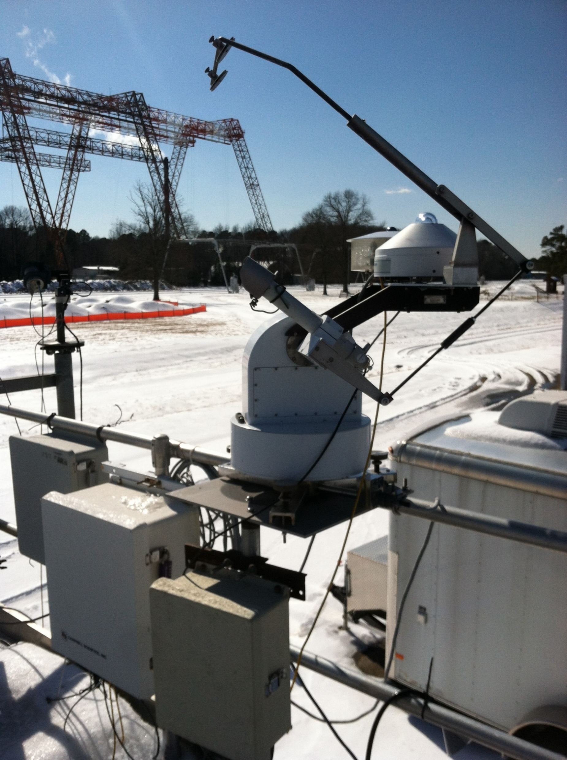 The BSRN-LRC sun tracker at the NASA Langley Research Center on a snowy day (02/20/2015)